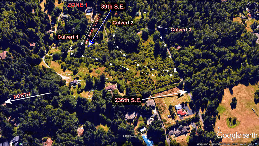
ZONE ONE - THE DRY GROUND

The culverts that carry the storm water/surface water under 39th
Ave S.E. are noted zoomed out. The water passing through the updated
culvert view (Please note the addition of newly discovered culvert)
is flow direction indicated by the dashed arrows.
Culverts Closeup [Three][Two][One] Some History
Another perspective HERE and HERE

HELP *  Use your Backspace key/return function to revisit a map/page.
* For desktop/laptop users - Place cursor over emboldened text, colored
and/or underlined, for explanations.
|