During the council hearing on November 15th the non profit organization S.A.V.E.
who oppose the removal of Zone 1 from the Critical Species Habitat LID overlay
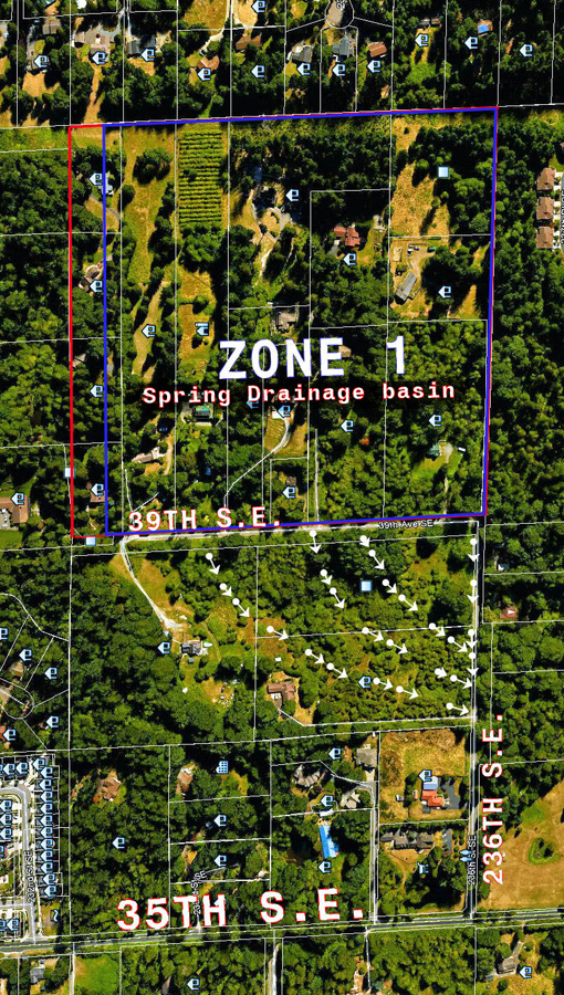
noted with drawings the existence of "three culverts" under 39th Avenue S.E.
that transfer water from Zone 1, east of 39th Avenue S.E., to the land that lies
west of 39th. Note overhead map with arrows indicating flow toward 236th S.E.
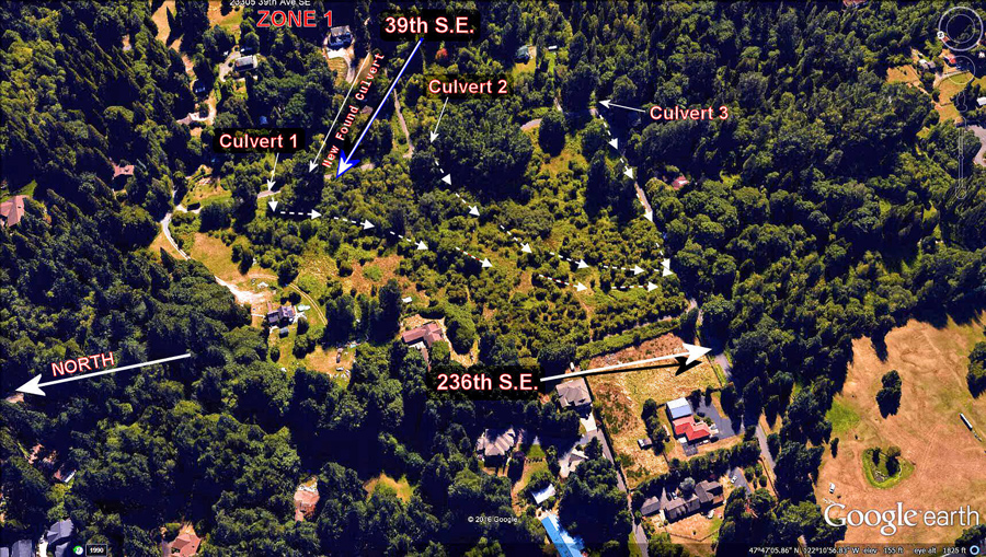
For the record there are in fact four culverts under 39th Avenue, one more
recently discovered when the city cleaned the drainage ditch that runs on the
east side of 39th Avenue. Note original 3D view updated
It is true that the culverts transfer the water that slopes downhill toward 39th
per the shallow aquifer that is frequently noted and also included in the
science component finalized per the best available science update by Parametrix,
that was required by the Growth Management Board.
Here is a photograph taken of the bulk of the output of the shallow aquifer in
July of 2016. Note that the previous Spring was a period of considerable
rainfall, no drought, and that a good snow pack existed from the previous winter
unlike the year 2015. The inclusion in the photograph of the house construction
that did not exist in 2015 dates for validity.
Photograph of The Bulk Output
Most importantly, other than the mere rivelet of water, is the fact established
by Parametrix that the water flow from Zone 1 travels south away from the Cole
Creek drainage, the first step in establishing that Zone 1 is set apart from the
three creek fishery of the Critical Species Habitat.
* Note the overhead map outlining Zone 1 and the surface water flow (arrows)
west of 39th Avenue, a fact established by existing city of Bothell surface water
flow maps and also updated by Parametrix. Overhead Map
* Next, note the map establishing the location of the newly discovered culvert,
for clarification, adding to the set of culverts under 39th Avenue.
New Discovered Culvert
* Next noting, zoomed out, the map showing the waterflow (arrows) as it
collects in the north side drainage ditch along 236th Avenue S.E. and travels
west to 35th Ave S.E.
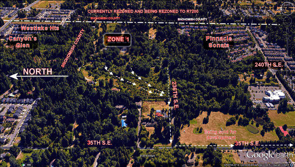
This establishes what weather generated storm water adds to trace the natural
flow of water from Zone 1, a tracer that mixes the shallow aquifer ouput and
carries down slope to 35th Avenue S.E.
When the water reaches 35th Avenue S.E., all easily observable on site, it takes
a hard turn south under 236th to travel down the east side drainage ditch of
35th Avenue -- to travel under the intersection at 240th Avenue S.E. beyond and
into a man made wetland in the business park.
The water depicted reaches North Creek, hence, as all water in the North Creek
drainage does, including the vast majority of the south bound drainage north of
the three creek fishery in the Critical Species Habitat
It has been noted - the insignificance of water originating from Zone 1
regarding the drainage and also the fact that Zone 1 is set apart from the three
creek fishery of the Critical Species Habitat. It has also been noted by a
sitting council person that Zone 1 should never have been included in the
Critical Species Habitat. It was unfortunatly done so based not on tests done
directly in the Zone but rather using assumptions spread from data based
elsewhere.
HELP * Use your Backspace key/return function to revisit a map/page.
|